

The Levi Fell area in Kittilä has a great winter and summer trail network. Some winter activities include winter walking and biking trails, snowmobiling, and cross-country and downhill skiing. During summer, you can enjoy hiking and nature trails, and even downhill or mountain biking.
Kapsajoki River and Ounasjoki River offer great opportunities for water activities. In Kittilä and nearby, Metsähallitus maintains areas where you can ski and hike, as well as fish in places like Pyhäjärvi River or Kapsajoki River, for example. About 1/3 of Pallas-Yllästunturi National Park is in Kittilä Municipality and offers a wide range of opportunities for outdoor activities.
You can also pick berries or mushrooms, fish, take photographs of incredible nature, or even get to know the local history.
Kittilä Municipality plans and maintains trails
The technical department takes care of the planning, building, and maintaining of trails that are the municipality’s responsibility, including the structures on trails, as well as the cross-country and snowmobile tracks and their accessibility.
The municipality is responsible for Levi’s nature, hiking, winter walking, and biking trails. The biking trails partially follow an old Metsähallitus hiking trail, and Metsähallitus is responsible for the structures in those areas. Kittilä Municipality is also responsible for the signs, structures, and the municipality’s rest areas’ firewood and waste management on cross-country and snowmobile tracks. The trails also have rest areas owned and maintained by Metsähallitus.
Kittilä Municipality and Oy Levi Ski Resort Ltd work in cooperation to maintain trails in the area. Levi Ski Resort maintains the ski and snowmobile tracks in the Levi area, and the municipality maintains the ski tracks in Kittilä Village and the winter hiking trails in Levi.
Trails
Hiking trails in Levi
The municipality maintains nature trails that can be found in the Levi area:
- Peak Trail, Levi, about 500m. The accessible gondola lift offers a scenic tour to visitors in wheelchairs and families with children in prams. The trail begins at the Gondola2000 lift peak station on Gondolitie.
- Ice Age Geological Trail, 9km, starts from Levi Summit or Front Slopes
- Life of the Past Trail, 18km, recreates the relationship between man and nature in the late 18th century, runs around the entire fell and begins at the starting point for Levi routes
- Shaman Päiviö’s Path – The Trail of the Great Shaman, 1,1km, starts on Levin Ympärystie
Kätkätunturi Fell trails begin on Myllyjoentie near the Levi Tourist Information office
- Kätkätunturi Fell Peak Trail, 9,1km back and forth, about 12km loop
- Kätkä-Pyhätunturi Fell Trail, 22,7km
More information about trails can be found here: Outdoor Active, Levi and Kittilä – Outdooractive.com
Read more about trails on the Visit Levi website at: Hiking and Trekking in Levi – levi.fi
Hiking and mountain biking trails
There are a number of marked trails of different lengths in the Levi area. You can find more information about them on the Levi website. You can also purchase a hiking and mountain biking trail map from the Levi Tourist Information office (016 639 3300), as well as Kittilä Municipal Information Services (0400 356 500), for trails outside of the Levi area (Levi, Kätkätunturi Fell, Pyhätunturi Fell, Aakennustunturi Fell).
Download the maps here:
Levi area hiking map 2020.pdf (4.92 MB)
Levi area biking map 2020.pdf (3.42 MB)
Read more about mountain biking on the Levi website!
You’ll also find an extensive trail network for biking and hiking in Pallas-Yllästunturi National Park. Certain trails are specifically maintained for biking, such as the Ylläs-Levi Fell bike route (50km), as well as other trails in the Ylläs area. Read more about the trails on the luontoon.fi website.
Winter walking and biking trails
About 33km of winter walking and biking trails are maintained during winter. In addition, there is a 7km long snowshoeing trail that is not maintained.
Trailheads:
- Upper-Levi (Ylä-Levi, Laaksokuja)
- Southeast Slopes
- South Point (Levin Ympärystie 1050)
- Draivi (Golfväylä 9)
There is parking available at each starting point.
It is recommended to use snowshoes when walking, even though on most trails it is possible to walk without them. Trails that are only meant for snowshoeing are specifically marked on the map. You’ll need a bike with wider tires (fat bike) when biking on the winter biking trails. Fat bikes can be rented from Zeropoint or other equipment rental shops in the area.
Levi winter walking and biking trails 2025-2026, downloadable pdf map:
Levi winter walking and biking trails 2025-2026.pdf
You can also check the electronic map service for updates: www.infogis.fi/levi
Rakkavaara Blueberry Forest – MTB
- The Rakkavaara forest area offers a point-to-point MTB trail that is about 2,4km long and ends near the Levi Golf area.
- The trail is a fun and easy blue flow route in the middle of a blueberry forest.
- The trail is meant only for mountain biking and is a one-way trail with seven passing bays, ensuring safety and smooth riding for all.
- The trail can be used as a training route, and experienced bikers can use it as a warmup before moving to a more challenging trail.
- The trail also works well as a loop during summer and fall months, since you can connect to a ski track that runs back to the starting point.
- More information about the trail’s location can be found here by searching Rakkavaaran Mustikkametsä: https://www.infogis.fi/levi/
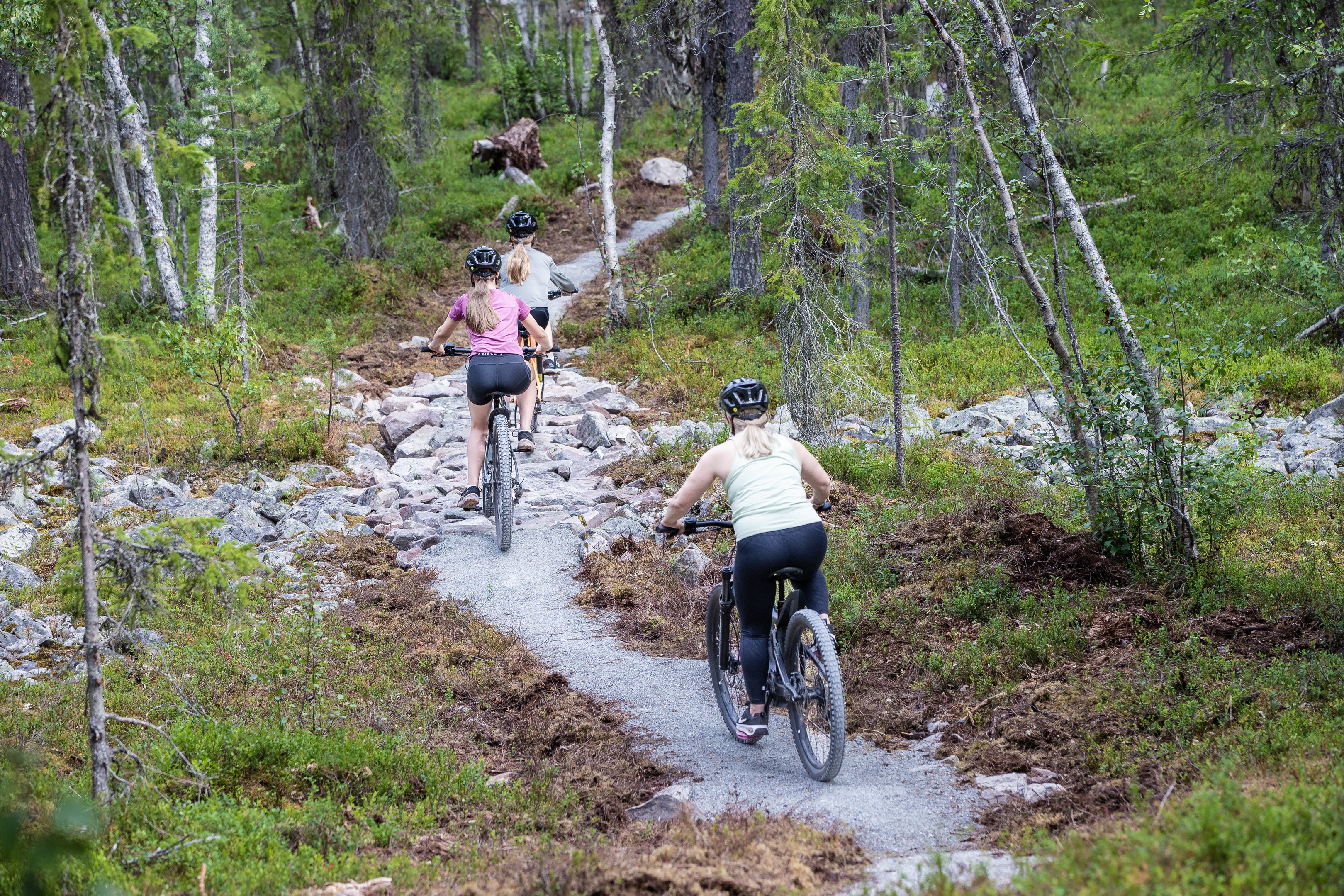
Photo: Levi Ski Resort / Teemu Moisio
Kapsajoki River trail
The Kapsajoki River in Kittilä offers a diverse and easily accessible river trail that is 95km long. It starts at Kittilä’s southern Pyhäjärvi River and follows along Kapsajoki River, all the way to Ounasjoki River at Torppaniva landing area in Sirkka (Levi). There are twelve landing areas along the route, and some of these areas are accessible by car, so they can be used as starting or ending points as well.
Read more: Kapsajoki River trail | kittila.fi (in Finnish)
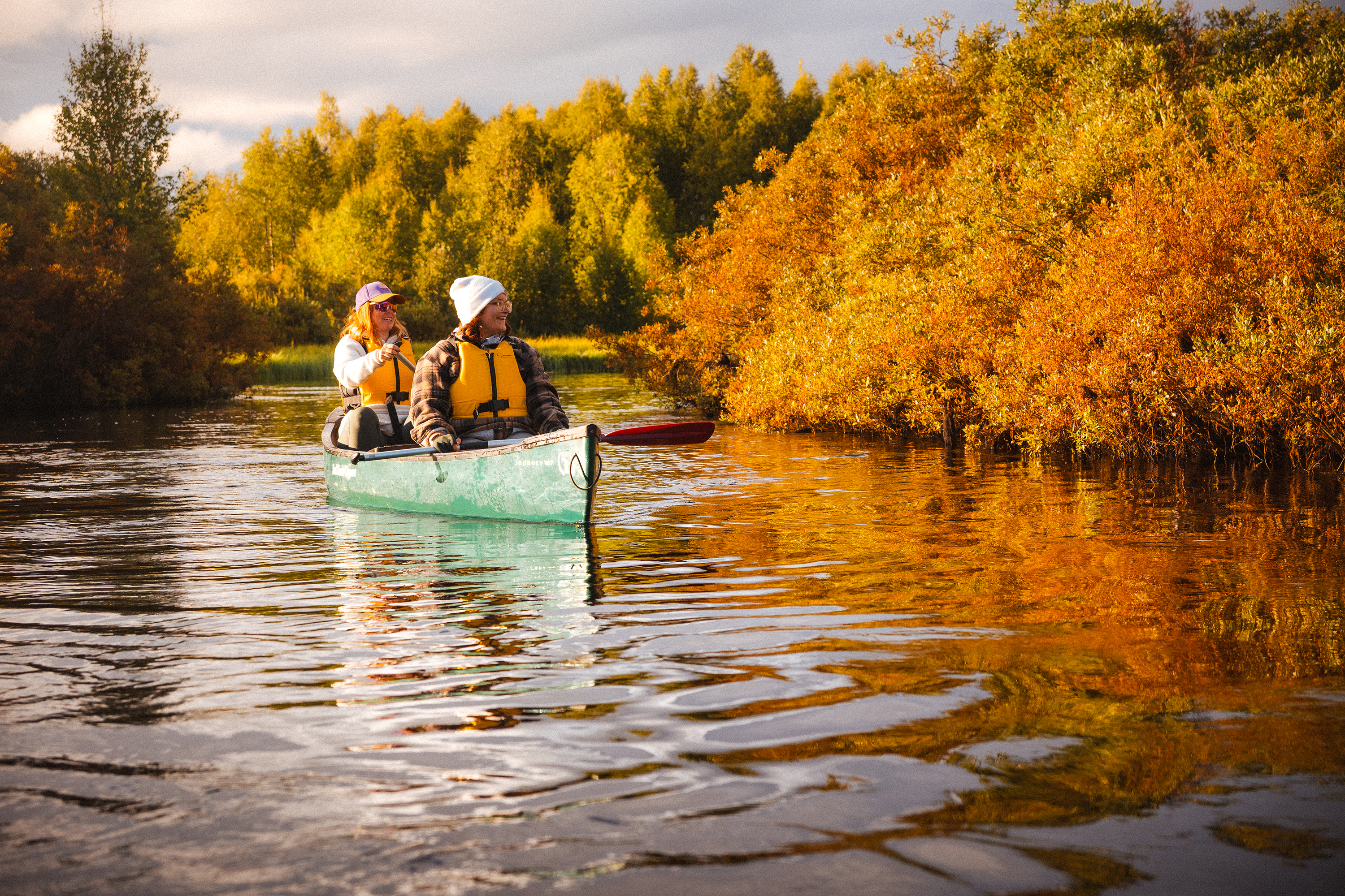
Kuva: Kittilän kunta / Janne Pussila
Hiking trails and resting stops
You’ll find all trails and resting stops, as well as other information on the Retkikartta-map service: retkikartta.fi
Read more about fells and scenic areas in Kittilä (in Finnish) Tunturi- ja maisemakohteita Kittilässä | kittila.fi